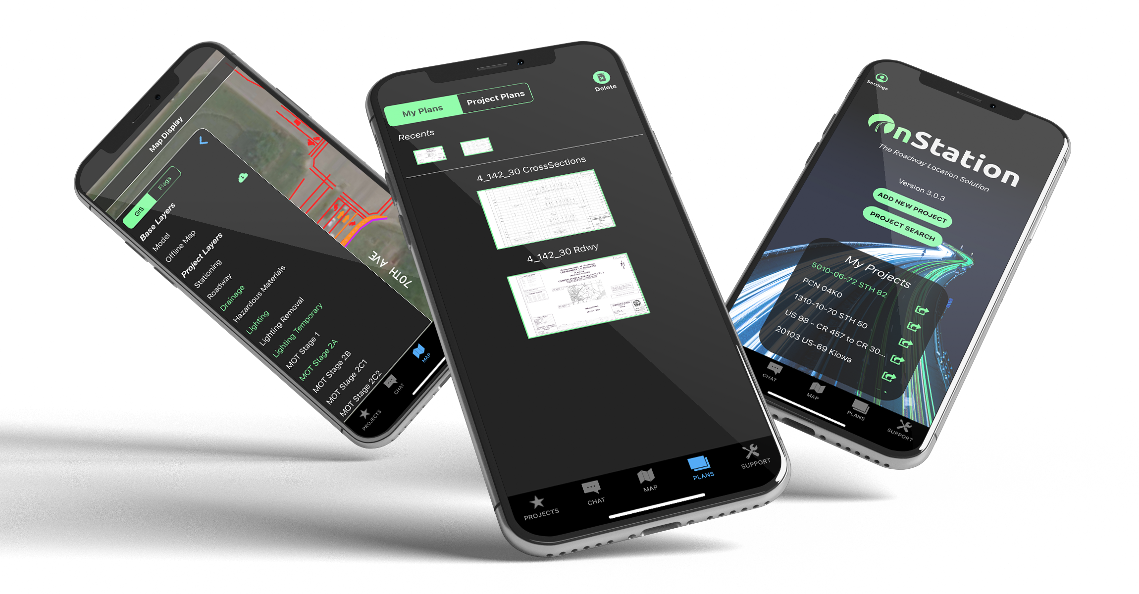
Find it. Add it. Experiance it.
Our Features
Why Choose Us?
%20-%20iPhone%20-%203.0.png?width=1000&height=1500&name=Map%20Tab%20(STA)%20-%20iPhone%20-%203.0.png)
Accurate Mobile Stationing
Instantly know stationing, LRS/mile marker, or Lat/Lon information.
Updated Project Plans
Eliminate paper plans by providing documents within the mobile app for anyone on the project to access.
Centralized Communication
Chat with varies contacts across multiple organizations in one place.
Visualize Project Designs
Overlay design layers on any project for crews to reference .
User Station
Hear From Our Users
How It Works
There’s a better way to locate.
🎵 Easy Like Sunday Morning 🎵 A recent study shows that implementing the OnStation app takes minimal effort and new users start reaping benefits after logging for the first time.
No stationing? No problem! The Mile Marker tool is available in over 25 states.

Resources
The Proof Is In The Pudding
OnStation Vs Google Earth
We will walk through some of the core difference between OnStation and Google Earth in-depth, but here's a quick glance at the core differences for construction users.
Phend & Brown - Case Study
Thad Justice, Geomatic Machine Control Specialist, and Andy Brown, President, talk about their experiences with using OnStation while on the US 30 corridor project located in Fort Wayne, Indiana.
West Davis County - Case Study
As of December 8, 2021, five months since construction began, OnStation has saved the project an average of 51 days (73,440 minutes) of time and an estimated cost savings of $48,738.
What The Community Is Saying
There are several [benefits] including locating points on the project, seeing items in a position where they go, being able to view plans without having to carry a large print set. Being able to set flags and chats to communicate with others on the project along with photos of the areas of concern, having a method to record items for record keeping. Richard Avery, Duit
In ten years or maybe tomorrow you WILL be using this or something like it. I lived through the revolution of GPS equipment being mounted on excavation equipment... trying at times and now it literally can't be done without it. PM, WisDOT
It is really good for sharing information and retaining information. Unlike text messages which can’t become part of the files. I especially see it’s usefulness with dealing with soil erosion, temporary traffic controls and other misc issues like punch lists. Michal Zylstra, HNTB
.jpeg?width=300&height=300&name=imagejpeg_0(1).jpeg)
